GRAN CANARIA


Reserva de la Biosfera
El pasado 29 de junio de 2005 fue declarada por la UNESCO la Reserva de la Biosfera de Gran Canaria. Con este apreciado galardón la isla de Gran Canaria se incorpora a la Red Mundial de Reservas de
la Biosfera -de la que ya formaban parte en Canarias las islas de Lanzarote, La Palma y El Hierro- dependiente del Programa MaB de la UNESCO (MaB, del inglés Man and Biosphere, el Hombre y la
Biosfera), programa que presta una especial atención a la relación entre las comunidades humanas y el medio natural.
Con la Reserva de la Biosfera de Gran Canaria fueron declaradas en la última reunión de la Mesa del Consejo Internacional de Coordinación del MaB celebrada en París en la fecha citada, un total de 23
nuevas Reservas de la Biosfera, de modo que la Red queda integrada actualmente por 482, repartidas en 102 países, con algunas transfronterizas.
En el caso de Gran Canaria, la isla del archipiélago canario más densamente poblada - con 1.500 km2 de superficie su población de hecho ronda los 900.000 habitantes - que ha destacado por la
laboriosidad de sus habitantes y la marcada vocación comercial y portuaria de su capital, Las Palmas de Gran Canaria, se da la circunstancia que los puntos tradicionales de entrada en la isla, puerto
y aeropuerto, se ubican en la zona más urbanizada y en la fachada más árida de la Isla respectivamente, lo que ha contribuido a que la naturaleza de Gran Canaria haya sido la gran
desconocida.
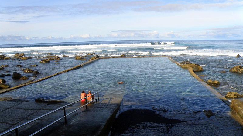
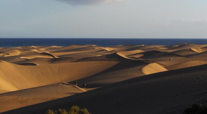
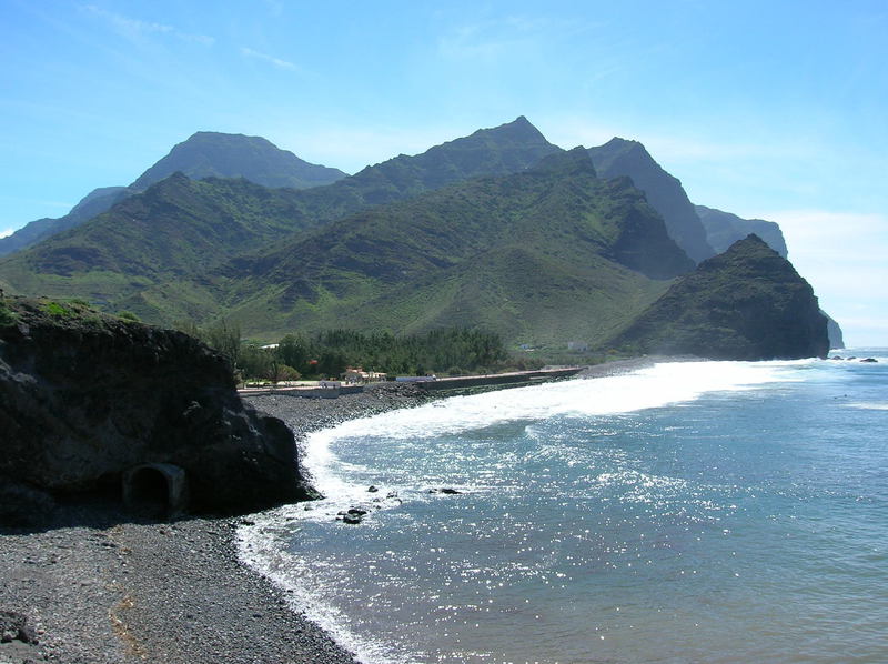
La excepcional playa capitalina de Las Canteras - protegida del mar abierto por un arrecife que discurre paralelo a la línea de costa - y en el extremo sur de la Isla la exótica playa de Maspalomas -
con sus dunas, laguna y oasis de palmeras- han centrado buena parte de la atención del visitante, eclipsando en cierta medida al interior insular lleno de belleza y valores patrimoniales.
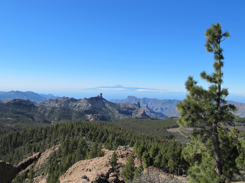
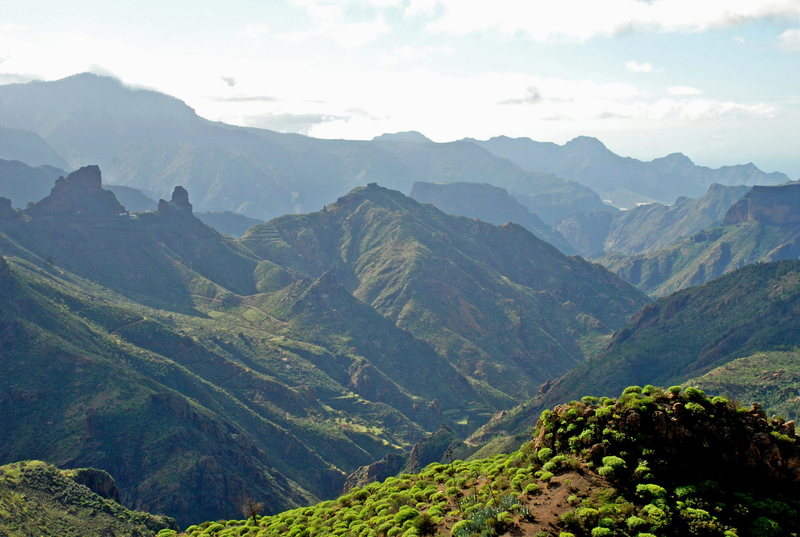
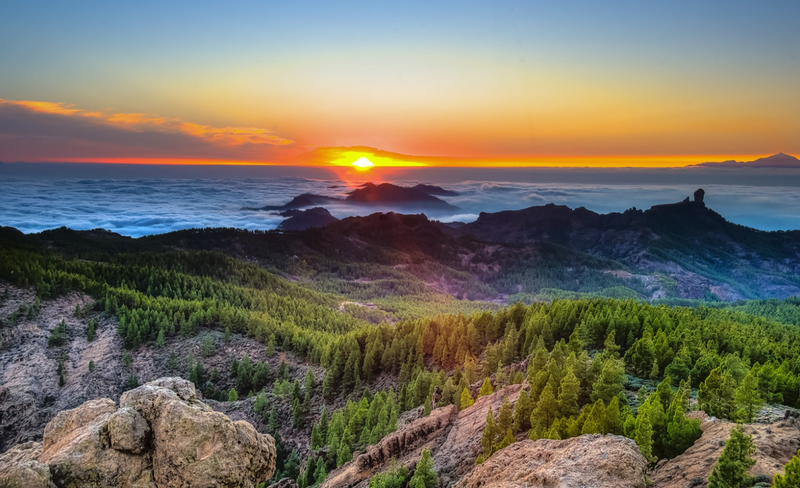
La UNESCO ha venido a refrendar algo que para los conocedores del interior de Gran Canaria era evidente: la grandiosidad y amenidad de sus paisajes, sus excelentes pinares y su rica biodiversidad,
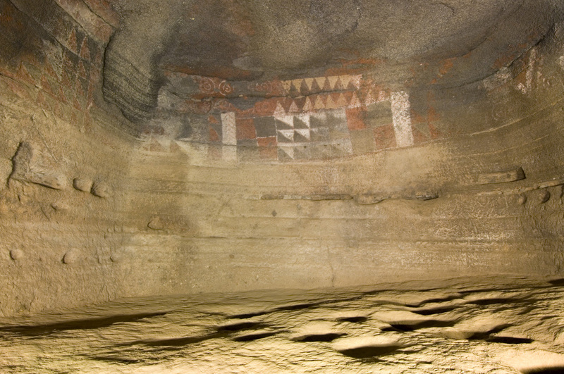
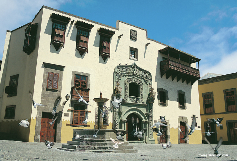
con una obra humana que se traduce en un extraordinario patrimonio cultural, tanto en sus aspectos arqueológicos - con riqueza y variedad de yacimientos- como etnográfico, donde la arquitectura y la
agricultura tradicional, surgidas de una íntima simbiosis entre el hombre y su medio, conforman un atractivo mosaico de pequeños asentamientos y cultivos en bancales, en cuyos pobladores aún hoy
pervive un singular patrimonio inmaterial.
La Reserva de la Biosfera, promovida por el Cabildo de Gran Canaria, lo ha sido en un proceso que ha contado con una amplia participación ciudadana. Comprende un extenso sector de la Isla y su orla
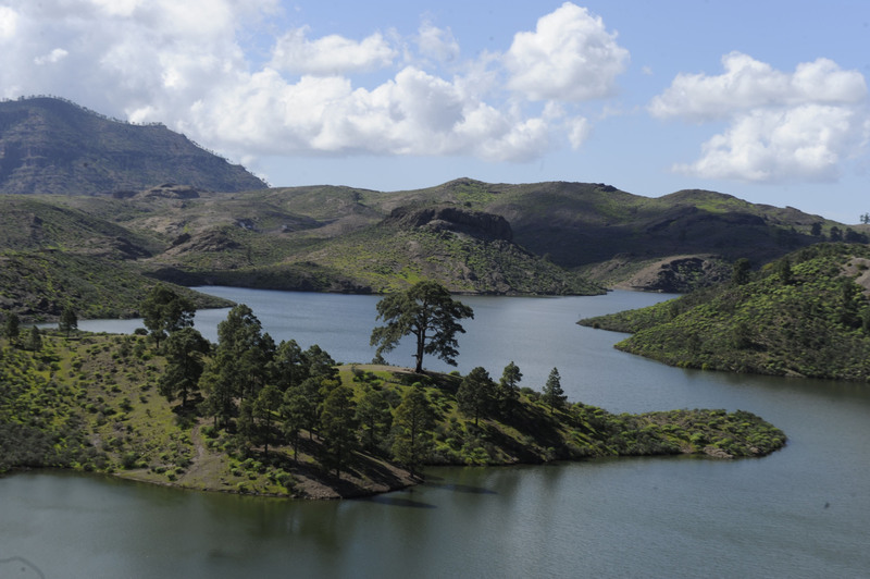
marina adyacente, donde su parte terrestre abarca el 46% (69.000 hectáreas) del territorio insular en su mitad occidental, con dos zonas núcleos (las Reservas Naturales de Inagua y Güi-Güi) y sus
correspondientes zonas de amortiguación y transición. La población asentada en la zona delimitada es de 18.000 habitantes.
La parte marina comprende una zona de transición que incluye la totalidad del Lugar de Interés Comunitario (LIC) denominado Franja Marítima de Mogán -orla de ocho kilómetros de anchura que discurre
desde la Punta de Maspalomas, extremo sur de la Isla, hasta la Punta del Descojonado, extremo occidental- más una franja adicional de 2.5 kilómetros de anchura que a partir de este punto alcanza
hasta el Puerto de las Nieves en Agaete, con una zona de amortiguación de 200 metros de anchura en su contacto con la zona núcleo terretre de Güi-Güi.
En la Reserva de la Biosfera de Gran Canaria se encuentran las rocas más antiguas de la Isla -basaltos que afloraron a la superficie del Atlántico hace 14,5 millones de años- y los testimonios más
apasionantes de su historia geológica, donde destacan los afloramientos de rocas vivamente coloreadas, resultado de procesos hidrotermales subsiguientes al colapso de la gran cámara de la que
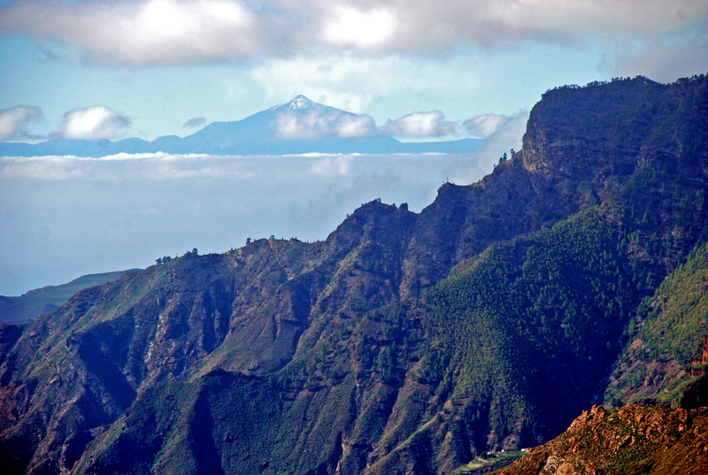
surgieron aquellas primeras rocas de la isla emergida, mientras los impresionantes roques como el Nublo y el Bentayga, erguidos sobre los abismos, nos hablan de las poderosas fuerzas que les dieron
vida.
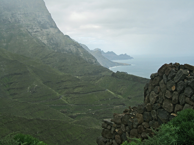
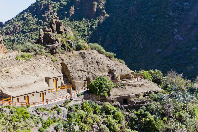
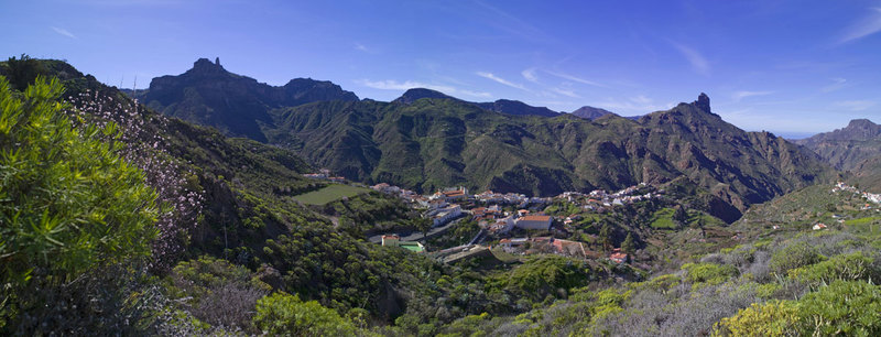
Roques, intrincados barrancos y altos desfiladeros confieren tanta fortaleza y singularidad a este paisaje que don Ramón de Unamuno al contemplarlo lo describió como “tempestad petrificada”. Los
pintorescos pueblos y caseríos junto a los pequeños campos de labor dispuestos en las laderas como bancales a modo de cadenas, son la nota acogedora que denota el esfuerzo de los campesinos que,
durante siglos, han obtenido de estas abruptas tierras su sustento.
En estos momentos el Cabildo de Gran Canaria está ocupado en la constitución de los órganos de gestión de la Reserva de la Biosfera, centrados en un consorcio con amplia representación de los agentes
sociales, así como en la puesta en marcha de un plan de acción con un horizonte a diez años vista, que lleve a la práctica los principios del desarrollo sostenible y el intercambio de
experiencias.
A corto plazo, se pretende ampliar la zona núcleo al ámbito marino; a medio, ampliar gradualmente los límites del ámbito terrestre y, a más largo plazo, incorporar la mayor parte de la Isla, de modo
que los principios que inspiran la Reserva de la Biosfera se trasladen hasta los ámbitos urbanos para conseguir ciudades sostenibles que generen sinergias, tanto con los ámbitos rurales que atesoran
tradiciones centenarias –incluido un valioso patrimonio inmaterial- como con los entornos más naturales depositarios de una valiosa biodiversidad.

Biosphere Reserve
On June 29, 2005 was declared a UNESCO Biosphere Reserve of Gran Canaria. With this esteemed award the island of Gran Canaria joins the World Network of Biosphere Reserves -of which were already part in Lanzarote Canary Islands, La Palma and El Hierro under the UNESCO MAB Programme (MAB English Man and Biosphere, the Man and the Biosphere) program pays special attention to the relationship between human communities and the natural environment.
The Biosphere Reserve of Gran Canaria were declared at the last meeting of the Bureau of the International Coordinating Council of MAB held in Paris on that date, a total of 23 new Biosphere Reserves, so the network is integrated currently 482, spread over 102 countries, with some cross-border.
In the case of Gran Canaria, Canary Island archipelago densely populated - with 1,500 km2 in fact its population is around 900,000 inhabitants - which has stood by the industriousness of its people and the strong commercial and port vocation of the capital, Las Palmas, given the fact that traditional points of entry into the island, port and airport are located in the urban area and in the most arid facade of the island respectively, which has contributed to nature Gran Canaria has been the great unknown.
The outstanding capital of Las Canteras beach - protected from the open sea by a reef that runs parallel to the coastline - and at the southern end of the island exotic beach of Maspalomas - with its dunes, lagoon and oasis focused palmeras- much of the attention of visitors, somewhat eclipsing the inner island full of beauty and heritage values.
UNESCO has been to endorse something for connoisseurs of the interior of Gran Canaria was clear: the grandeur and amenity of its landscapes, its great pine forests and rich biodiversity, with a human work which translates into an extraordinary cultural heritage in archaeological aspects - with richness and variety of yacimientos- as ethnographic, where architecture and traditional agriculture, arising from an intimate symbiosis between man and his environment, make an attractive mosaic of small settlements and terraced fields, whose inhabitants still It survives today a unique intangible heritage.
The Biosphere Reserve, promoted by the Cabildo of Gran Canaria, has been in a process which has received broad public participation. It comprises a large sector of the island and its adjacent sea border, where his land part covers 46% (69,000 hectares) of the island territory in the western half, with two core areas (the Nature Reserves of Inagua and GUI-GUI) and its appropriate buffer zones and transition. The population living within the area is 18,000 inhabitants.
The marine part comprises a transition zone that includes the entire Site of Community Interest (SCI) called Maritime Gaza Mogan Orla eight kilometers wide that runs from Punta de Maspalomas, south end of the Island, to Punta del Descojonado, Western-end plus an additional strip of 2.5 kilometers wide that from this point reaches up to the Puerto de las Nieves in Agaete, with a buffer zone of 200 meters wide at its contact with the core area terretre Güi-güi.
In the Biosphere Reserve of Gran Canaria are the oldest rocks that surfaced -basaltos Island to the surface of the Atlantic 14.5 million years ago and the most exciting testimonies of its geological history, which include outcrops vividly colored rocks, the result of subsequent collapse of the great camera that came those first emerged rocks island, while the impressive rocks as the Nublo and Bentayga, upright on the earth, hydrothermal processes speak of the powerful forces They gave them life.
Roques, intricate gorges and high passes give such strength and uniqueness to this landscape that Ramon de Unamuno to contemplate described it as "petrified storm". The picturesque villages and hamlets with small labor camps arranged as terraced hillsides like a chain, are the cozy note that denotes the efforts of farmers who, for centuries, been obtained from these rugged land their livelihoods.
At present, the Cabildo of Gran Canaria is busy setting up the management bodies of the Biosphere Reserve, centered in a consortium with broad representation of the social partners, as well as the implementation of an action plan a horizon to ten years ahead, leading to practice the principles of sustainable development and exchange of experiences.
In the short term, we intend to expand the core area to the marine environment; medium, gradually expand the boundaries of the land area and, in the longer term, incorporating most of the island, so that the principles underlying the Biosphere Reserve to move to urban areas to achieve sustainable cities that generate synergies both in rural areas who cherish old traditions - including valuable immaterial heritage as the most natural environments repositories of valuable biodiversity.

Biosphärenreservat
Am 29. Juni 2005 wurde von der UNESCO zum Biosphärenreservat von Gran Canaria erklärt. Mit dieser begehrte Auszeichnung der Insel Gran Canaria verbindet die Weltnetz der Biosphärenreservate -of denen gehörten bereits in Lanzarote Kanarische Inseln, La Palma und El Hierro unter dem UNESCO-MAB-Programms (MAB Englisch Man and Biosphere, der Mensch und die Biosphäre) Programm legt besonderen Wert auf die Beziehung zwischen menschlichen Gemeinschaften und der natürlichen Umwelt.
Das Biosphärenreservat von Gran Canaria wurden in der letzten Sitzung des Präsidiums des Internationalen Koordinierungsrates der MAB in Paris an diesem Datum statt erklärt, insgesamt 23 neue Biosphärenreservate, so dass das Netzwerk noch integriert 482, mehr als 102 Ländern zu verbreiten, mit einigen grenzüberschreitenden.
Im Fall von Gran Canaria, die Kanarische Insel von der Archipel dicht besiedelten - mit 1.500 km2 in der Tat seine Bevölkerung rund 900.000 Einwohner -, die von der Fleiß der Menschen und der starken
Handels- und Hafen Berufung der Hauptstadt Las Palmas gestanden hat, angesichts der Tatsache, dass traditionelle Eintrittspunkte in die Insel, Hafen und Flughafen sind im Stadtgebiet und in der
trockensten Fassade der Insel verbunden, die die Natur zu Gran Canaria beigetragen hat, befindet hat die große unbekannt.
Die ausstehenden Kapitals von Las Canteras Strand - und am südlichen Ende der Insel exotischen Strand von Maspalomas - - vom offenen Meer durch ein Riff, die parallel zur Küste verläuft geschützt mit seinen Dünen, die Lagune und Oase konzentriert palmeras- Großteil der Aufmerksamkeit der Besucher, ein wenig verdunkelt die innere Insel voller Schönheit und das Erbe Werte.
UNESCO war es, etwas für Genießer des Inneren Gran Canaria zu billigen war klar: Die Größe und Ausstattung der seine Landschaften, seine große Pinienwälder und reiche Artenvielfalt, mit einem menschlichen Arbeit, die in eine außergewöhnliche kulturelle Erbe an archäologischen Aspekte übersetzt - mit Reichtum und die Vielfalt der yacimientos- als ethnographische, wo Architektur und die traditionelle Landwirtschaft, die sich aus einer innigen Symbiose zwischen Mensch und seiner Umwelt, stellen ein attraktives Mosaik aus kleinen Siedlungen und Terrassenfelder, deren Bewohner noch es überlebt heute eine einzigartige immateriellen Erbes.
Das Biosphärenreservat von der Cabildo von Gran Canaria gefördert, hat in einem Verfahren, das breite Beteiligung der Öffentlichkeit aufgenommen wurde. Es besteht aus einem großen Sektor der Insel und ihrer angrenzenden Meer Grenze, wo sein Land Teil deckt 46% (69.000 Hektar) der Insel Gebiet in der westlichen Hälfte, mit zwei Kernbereichen (die Naturschutzgebiete von Inagua und GUI-GUI) und ihre entsprechenden Pufferzonen und Übergangs. Die Bevölkerung in der Umgebung ist 18.000 Einwohnern.
Der marine Teil eine Übergangszone, die das gesamte Gebiet von gemeinschaftlicher Bedeutung (SCI) enthält umfasst genannt Maritime Gaza Mogan Orla acht Kilometer breit, die von Punta de Maspalomas, südlichen Ende der Insel, um Punta del Descojonado, West-End und einem zusätzlichen läuft Streifen von 2,5 Kilometer breit, dass von diesem Punkt reicht bis zum Puerto de las Nieves in Agaete, mit einer Pufferzone von 200 Metern Breite an seinem Kontakt mit dem Kernbereich terretre Güi-güi.
Im Biosphärenreservat von Gran Canaria sind die ältesten Gesteine, die -basaltos Insel an der Oberfläche des Atlantiks vor 14.500.000 Jahre aufgetaucht und die aufregendsten Zeugnisse von seiner geologischen Geschichte, die Aufschlüsse sind klar farbigen Felsen, das Ergebnis der anschließenden Zusammenbruch der großartige Kamera, die denen zum ersten Mal aufgetaucht Felsen-Insel, während die beeindruckenden Felsen als Nublo und Bentayga, aufrecht auf der Erde, hydrothermale Verfahren sprechen von den mächtigen Kräften Sie gaben ihnen das Leben.
Roques, komplizierte Schluchten und hohe Pässe geben, wie Stärke und Einzigartigkeit dieser Landschaft, dass Ramon de Unamuno, um beschrieb es betrachten, wie "versteinerten Sturm". Die malerischen Dörfer und Weiler mit kleinen als terrassierten Hänge wie eine Kette angeordneten Arbeitslagern, sind die gemütliche Note, die die Bemühungen der Landwirte, die seit Jahrhunderten von diesen robusten Land ihren Lebensunterhalt erhalten worden bezeichnet.
Derzeit ist der Cabildo von Gran Canaria ist besetzt Einrichtung der Verwaltungsorgane des Biosphärenreservat, in einem Konsortium mit breite Vertretung der Sozialpartner zentriert ist, sowie die Umsetzung eines Aktionsplans ein Horizont, um zehn Jahre voraus, was zu befolgen die Grundsätze der nachhaltigen Entwicklung und den Austausch von Erfahrungen.
Kurzfristig wollen wir den Kernbereich für die Meeresumwelt zu erweitern; Medium nach und nach erweitern die Grenzen der Landfläche und, auf längere Sicht unter Einbeziehung meisten der Insel, so dass die Grundsätze des Biosphärenreservats auf städtische Gebiete zu bewegen, um eine nachhaltige Städte, die Synergien sowohl in ländlichen Gebieten, die alt schätzen erzeugen zu erreichen Traditionen - auch wertvolle immaterielle Erbe wie die meisten natürlichen Umgebungen Repositories von wertvollen Biodiversität.
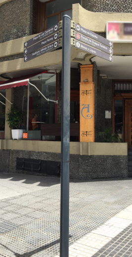
LAS PALMAS DE GRAN CANARIA MAP
Descárgate el mapa de la ciudad. Download the city map. Laden Sie den Stadtplan.
mapa_lpgc2.pdf
Documento Adobe Acrobat [4.3 MB]
mapa_lpgc_map_p02.pdf
Documento Adobe Acrobat [360.1 KB]
GRAN CANARIA MAP
Descárgate el mapa de la isla. Download the Island map. Laden Sie die Karte von der Insel.
nuevo_mapa_grancanaria.pdf
Documento Adobe Acrobat [22.1 MB]
 Servicios de Emergencias / Emergency Services / Notfalldienste